TOURDATA
Kaiser-Franz-Josef-Straße 27, 5640 Bad Gastein
The historical crossing over the Mallnitzer Tauern has lost its function as a transport route, but a hike across the main ridge of the Tauern is still a very special experience today. A hiking trail now runs along the remnants of the ancient Roman road. "In the footsteps of the Romans," the present is connected with history. Hikers learn interesting facts about the flora, fauna, and geological structure of the Tauern.
A taxi service takes us from Bad Gastein train station to Nassfeld (Sportgastein).
We walk along the nature trail through the long basin of this high valley, where the traces of former gold and silver mining are ever-present. Cattle can be observed grazing in the alpine meadows everywhere. After a good half-hour walk, we reach the ascent path to the Hagener Hut.
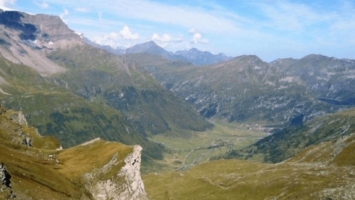
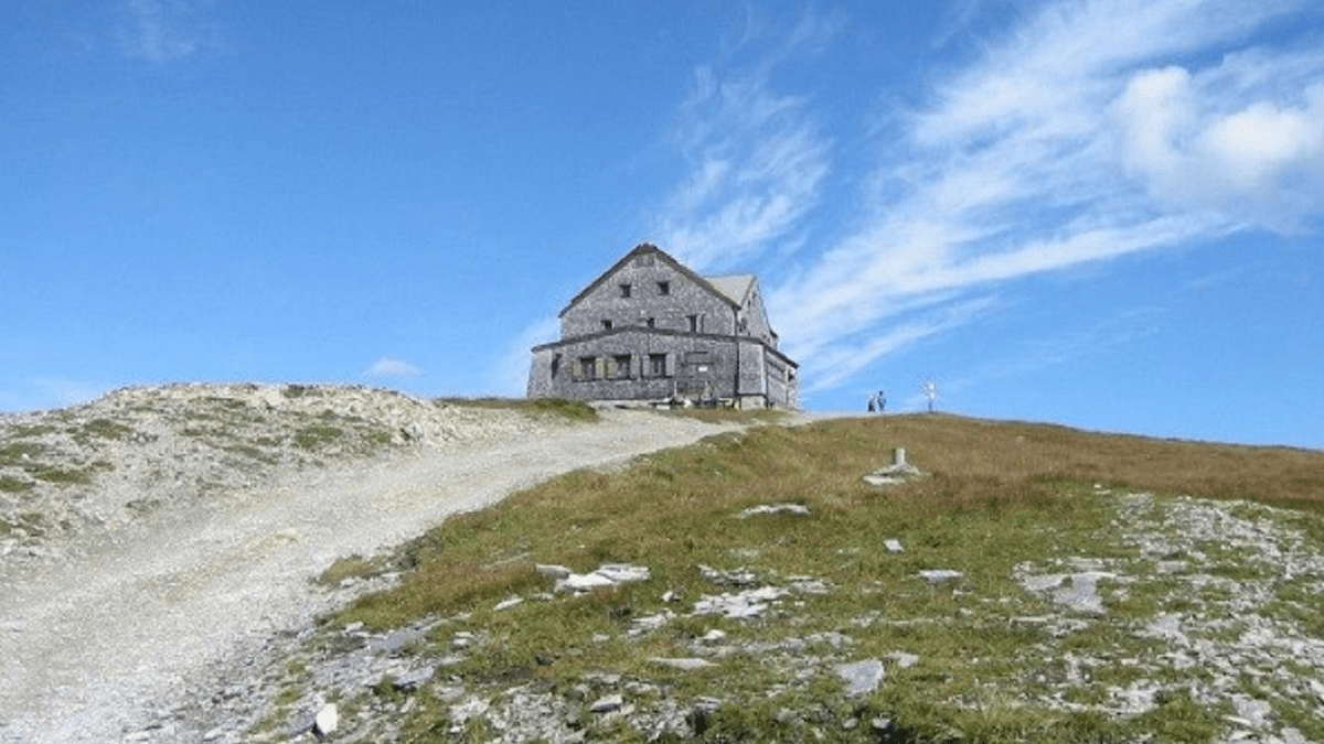
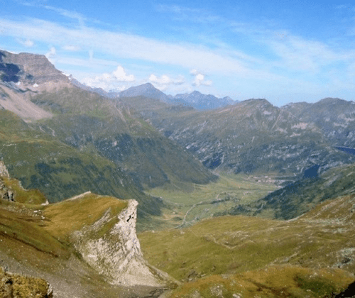
For the experienced mountain hiker, the trail, which is laid out in numerous switchbacks and crossings, is manageable. One quickly gains altitude and enjoys a magnificent view over the Nassfeld valley extending to the northern limestone Alps. The hiking trail intersects with the route of the 2,000-year-old Roman road several times. There is enough time to drink clear mountain water from springs. After about 3 hours of walking, we reach the Hagener Hut at an elevation of 2,446 meters via the Eselkar, which is the actual Tauern crossing. Here, both Celtic and Roman coins have been found, indicating that this crossing was used in pre-Roman times.
After a cozy break at the Hagener Hut, the hiking trail No. 110 leads us over the southern slope of the Alps, past the Tauernhaus, which Archduke Johann had built in 1836. Even today, the natural stone masonry and vaulted parts of the original building can be seen. The path, which is also laid out in numerous curves and is rather wide, takes us through the magnificent "Tauern meadows" and alpine pastures.
After about 2 hours of walking, we reach the Jamnigalm, located at an altitude of 1,745 meters. From the parking lot near the Jamnigalm, we are taken by bus to the Mallnitz train station. After a 20-minute train ride through the Tauern Tunnel, we return to Bad Gastein train station.
Meeting point: Bad Gastein train station Duration: approx. 9 hours (of which pure walking time is approx. 6.5 hours) Elevation gain: approx. 870 m Elevation loss: approx. 750 m Number of participants: at least 6 people Transfer costs: approx. € 40.00 per person (cash payment only) Hiking guide: Hans Naglmayr
Miscellaneous:
Ankle-high hiking or mountain boots with a good tread are absolutely necessary here.
Good physical condition is required.
What to bring: binoculars, camera equipment, snacks, and drinks.
Registration: by Wednesday at 4:00 PM
Spa and Tourism Association Bad Gastein
+43 6432 3393 560
badgastein@gastein.com